

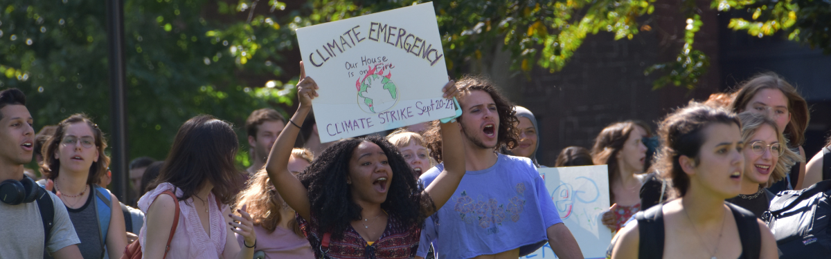

2021-22: Visualizing Environmental Change
Each academic year the COE gathers a small group of Wesleyan faculty members, a scholar of prominence from outside Wesleyan, and a small group of undergraduate students into a year-long academic think tank on a critical environmental issue. The aim of the think tank is not only to generate a deeper understanding of the thematic issue, but also to produce scholarly works that will influence national/international thinking and action on the issue. This year's Think Tank theme, Visualizing Environmental Change, will be the subject of our 2021 Where on Earth Are We Going? symposium to be held October 30 from 11 am to noon. The seminar, Recent Glacier-Related Flood Events in High Mountain Environments, will be conducted by Think Tank fellow Alton C. Byers, the Menakka and Essel Bailey '66 Distinguished Visiting Scholar in the College of the Environment.
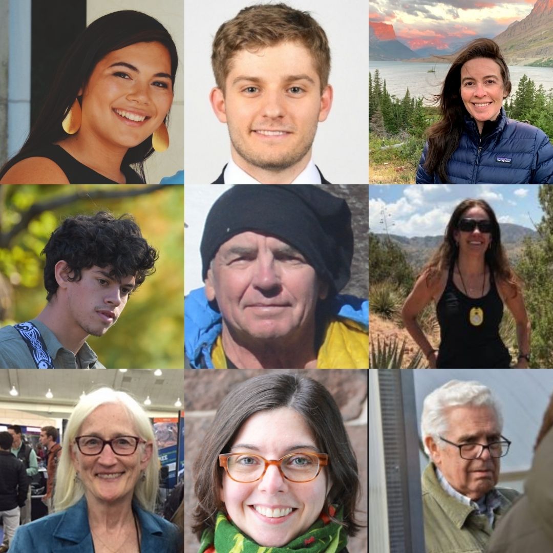
Our 2021-22 COE Think Tank faculty fellows are: Suzanne O’Connell, the Harold T. Stearns Professor of Earth Science; Jennifer Raynor, assistant professor of economics; Courtney Fullilove, associate professor of history; Helen Poulos, adjunct assistant professor of environmental studies; Antonio Machado-Allison, university professor in the College of the Environment; and Alton C. Byers, senior research scientist at the Institute of Arctic and Alpine Research (INSTARR) at the University of Colorado at Boulder and this year’s Menakka and Essel Bailey ‘66 Distinguished Visiting Scholar in the College of the Environment. Olivia Baglieri ’22, Dylan Judd ’22, and Skye Hawthorne ’22 will also be joining the Think Tank as student fellows this academic year.
Efforts to raise consciousness about environmental crises have foundered on a paucity of immediate visual evidence, leading to inertia and resistance among policymakers and the general public. This failure of public imagination impedes meaningful action to remediate and avert damage to the global environment. This year, our COE Think Tank fellows are pursuing independent projects on visualizing environmental change. Suzanne O’Connell will produce a book-length study on glacial melt as a visual manifestation of anthropogenic climate change. Jennifer Raynor will use satellite images to identify economic activity, including illegal and small-scale fishing on the high seas. Courtney Fullilove will analyze the International Union for the Conservation of Nature (IUCN) Red Lists of Endangered Species as codices of biodiversity loss and symbols of endangerment. Helen Poulos will explore how melting glaciers influence the hydrologic cycle using ECOsystem Spaceborne Thermal Radiometer Experiment on Space Station (ECOSTRESS) remotely sensed data. Antonio Machado-Allison will investigate whether policies established by Venezuelan governments from 1958 to 2021 were enacted for protection, conservation or exploitation of natural resources in the Orinoco River basin. Alton Byers will pursue interdisciplinary and integrated approaches to improve the accuracy of tools to monitor glacial lake outburst floods (GLOF) and massive rockfalls in the Himalayas and the Andes.
Together these projects investigate the ways images make salient the effects of otherwise “invisible” behavior that is hurting the planet: Raynor considers how observation and tracking can help create appropriate incentives for people to take action around environmental issues; O’Connell uses visualization strategies to mobilize public awareness to overcome inertia; Fullilove analyzes how popular images of biodiversity loss may nevertheless privilege certain species and political actors, to the detriment of broader preservation mandates; Byers explores how practices of observation and measurement, including the establishment of baselines and organized replication in monitoring and evaluation (M&E) systems can support nonprofits and governments implementing projects to address community development, biodiversity preservation, and climate change; and more. The combined research of our COE Think Tank fellows aims to contribute to a literature on environmental awareness and public communications about environmental issues, as well as devising effective policies to mitigate harm.
Suzanne O’Connell
Melting: Consequences on a Global Scale
Earth is where we live, and humans are doing a poor job shepherding and preserving its many spheres and beauty. Human damage to the atmosphere is particularly visible when you look at the cryosphere (ice). Most mountain glaciers outside of the Himalayas and Alaska, the Alps, Andes, and Cascades are likely to disappear by the end of this century. The rapid melting and calving of Greenland and Antarctic ice sheets threatens coastlines everywhere.
Some statistics (Lindsey, 2020):
- Between 1980 and 2018, glaciers tracked by the World Glacier Monitoring Service have lost ice equivalent to 21.7 meters of liquid water— imagine cutting a 24-meter (79-foot) thick slice off the top of each glacier. That’s what has been lost.
- Melting glaciers and ice sheets are the biggest cause of sea level rise in recent decades.
- Glacier loss is a serious threat to ecological and human water supplies in many parts of the world.
My goal is to create a climate change book for lay audiences that will be both visual and impactful. Throughout the world, ice (cryosphere) is turning into water (hydrosphere) as a direct consequence of our warming atmosphere. Unlike the cause, increasing greenhouse gases, which cannot be seen, the ice to water transition is visual. This book will examine the impact of melting ice on humans and include maps and photographs, especially paired images of glaciers, pictures of ice taken from the same location decades apart.
Specific topics that I plan to research and write about include: Thirst (cities in the Andes), Electricity (hydropower – Switzerland), Food (Himalayas), Tourism (South America and the Alps), Disasters (glacial lake outflows (GLOFs), landslides and avalanches – Peru and Himalayas), Coastlines (sea level rise and the melting of the Greenland & Antarctic Ice Sheets), Memories (ice cores as a diary of change and human artifacts being uncovered by melting), Icons (three or four famous glaciated mountains that are losing their ice crowns), Obituaries (lost glaciers), and Biodiversity (probably a different title). Each chapter will discuss some possible solutions and adaptations and there will be a final, short chapter (The Way Out, that describes new technologies that will contribute to slowing climate change and adaptations to climate change. Possibly there will be a chapter on the cultural change as a result of melting – but I think I’m going to run out of time for this.
Some questions to address:
- How do people perceive environmental change and access to water?
- What can be done and has been done to prepare society for environmental change?
- Is it possible to slow the rapid changes to the cryosphere?
- How do we monitor climate change and melting, and how has that changed in the past 100 years?
Jennifer Raynor
Detecting Illegal, Unreported, and Unregulated Fishing using High-Frequency, High-Resolution Satellite Imagery
Illegal, unreported, and unregulated (IUU) fishing accounts for 20 percent of wild-caught fish globally and up to 40 percent in some regions (1). IUU fishing threatens efforts toward sustainable fisheries management. It also jeopardizes the livelihoods of legitimate fishers and coastal communities by diverting $10 billion to $23.5 billion dollars in fishing revenues annually (1). IUU fishing has also been connected to transnational crimes, including slave labor, piracy, and arms, drug, and human trafficking (2, 3). As a result, countries have made it a priority to stop IUU fishing (4); however, most IUU fishing is difficult to monitor and enforce because it is conducted by “dark fleets”—those that do not appear in monitoring systems (5, 6). The expansion of high-frequency, high-resolution satellites offers an opportunity to monitor previously invisible fishing activity and direct enforcement activities to the areas with highest risk and need.
This project will develop a machine learning model to identify and classify vessels in the U.S. Exclusive Economic Zone (EEZ), using multiple satellite technologies. These vessel detections will illuminate the full range of vessel activities, from scuba and sport fishing vessels to cruise ships and shipping vessels. The results will provide the basis for several strands of research, including: 1) identifying illegal intrusion of foreign vessels in the U.S. EEZ, 2) examining compliance of U.S. flagged vessels with fishing-prohibited areas, such as marine national monuments, and 3) measuring fishing effort in unregulated and unreported small-scale fisheries. We are working in collaboration with the U.S. Coast Guard and the National Oceanic and Atmospheric Administration’s Office of Law Enforcement to ensure these results have real world impacts on sustainable fisheries management and enforcement.
References
- D. J. Agnew, J. Pearce, G. Pramod, T. Peatman, R. Watson, J. R. Beddington, T. J. Pitcher, Estimating the Worldwide Extent of Illegal Fishing. PLOS ONE. 4, e4570 (2009).
- U. R. Sumaila, Fisheries, ecosystem justice and piracy: A case study of Somalia. Fisheries Research, 10 (2014).
- A. Telesetsky, Laundering Fish in the Global Undercurrents: Illegal, Unreported, and Unregulated Fishing and Transnational Organized Crime. Ecology Law Quarterly. 41, 939– 997 (2014).
- United Nations, Goal 14: Conserve and sustainably use the oceans, seas and marine resources. Sustainable Development Goals, (available at https://www.un.org/sustainabledevelopment/oceans/).
- R. Pelich, M. Chini, R. Hostache, P. Matgen, C. Lopez-Martinez, M. Nuevo, P. Ries, G. Eiden, Large-Scale Automatic Vessel Monitoring Based on Dual-Polarization Sentinel-1 and AIS Data. Remote Sensing. 11, 1078 (2019).
- G. Rowlands, J. Brown, B. Soule, P. T. Boluda, A. D. Rogers, Satellite surveillance of fishing vessel activity in the Ascension Island Exclusive Economic Zone and Marine Protected Area. Marine Policy. 101, 39–50 (2019).
Courtney Fullilove
Red Lists of Threatened Species in the South Caucasus
The IUCN [International Union for the Conservation of Nature] Red List of Threatened Species was first published in 1964 and revised in successive editions in the decades since, becoming the canonical document for designation and protection of endangered species internationally.1 Under the auspices of the the IUCN, numerous regional and national red lists have been published, offering sumptuous visual representations of world biodiversity under attack. This project is an analysis of the construction of the Red Data Book of the Russian Federation and Commonwealth of Independent States. This publication documents rare and endangered species of plants, animals, and fungi Russia and the post-Soviet republics of Armenia, Belarus, Kazakhstan, Kyrgyzstan, Moldova, Russia, Tajikistan, Turkmenistan, Ukraine, and Uzbekistan. Focusing on the South Caucasus republics of Georgia, Armenia, and Azerbaijan, I consider how legislation for endangered species devised for the Soviet Union in the 1970s was adopted or rejected by autonomous republics in the wake of the USSR’s collapse, whether the common ecological treaty had significant implications for the organization and preservation of biodiversity in a period of political and economic divergence, and how new republics sought to represent nature as a unique, common, or valuable object of preservation through the publication of regional and national red lists of threatened species.
The South Caucasus is a unique ecological region and biodiversity hotspot with claims of origin to many cultivated crops.2 The area of the Caucasus and Black Sea border defined 34 global biodiversity hotspots, 23 soil-climatic zones, and numerous endemic species of flora. Georgia harbors extensive diversity of cereal (wheat, barley, oat, rye), legume (pea, chickpea, lentil, faba bean), and fruit (plum, cherry, quince, grape) varieties, with an agricultural tradition dating to the 5/6th millennium BC.3 The collapse of the Soviet Union and the subsequent privatization of land holdings introduced numerous challenges to the preservation of biodiversity and food security, including decimated seed stocks, poaching and logging, loss of agrarian knowledge, land segregation, defunded infrastructure, lack of credit, and rural flight.4 The cases of the South Caucasus and the former USSR are important in their own right because of the region’s geographic scale and ecological significance, but they are also a microcosm for broader considerations about the framing of biodiversity as a regional, national, or international problem. This research is a part of my book manuscript in progress on The Uses of Biodiversity.
1 Ursula K. Heise, Imagining Extinction: The Cultural Meanings of Endangered Species, (Chicago: University of Chicago Press, 2016).
2 Caterina Batello, and Marzio Marzot. Gardens of Biodiversity: Conservation of Genetic Resources and Their Use in Traditional Food Production Systems by Small Farmers of the Southern Caucasus. Rome: Food and Agriculture Organization of the United Nations, 2010; James Clinton, Tatiana Solomon, Vladimirovna Shulkina, and George E Schatz. Red list of the endemic plants of the Caucasus: Armenia, Azerbaijan, Georgia, Iran, Russia, and Turkey, 2014.
Alton C. Byers
Reconstructing the History of Catastrophic Events in Remote Mountain Regions through Interdisciplinary and Integrated Approaches
Beginning the 1960s, climate change and warming temperatures have resulted an increased frequency and magnitude of catastrophic events in high mountain regions of the world, particularly in the Himalayas and Andes. These events include glacial lake outburst floods (GLOF), massive rockfalls triggered by changes in permafrost, glacier floods, and snow and ice avalanches. The databases that record these events are based upon reported and documented incidents, normally from populated regions with modern communication capabilities. Recent evidence suggests, however, that the actual frequency of catastrophic events is much higher than documented, most likely because of their occurrence in remote, high altitude, and communication-poor locations. Such inaccuracies have important bearings on the accuracy of predictive, preventative, and mitigating technologies.
This study will explore the role of interdisciplinary and integrated approaches to improving the accuracy of climate-related, high magnitude/low frequency events in the Nepal Himalayas. Although most contemporary glacier studies, for example, tend to focus strictly on the physical sciences, we hypothesize that an integration of the social sciences, in addition to remote and field-based tools such as remote sensing and oblique repeat photography, can provide more detailed analyses and records of events currently unknown to the scientific community. For example, Byers et al. (2020) used a combination of oral history, remote sensing, numeric flood modeling, and repeat photography to document the occurrence of eight GLOFs in the Kanchenjunga region of Nepal, where only one had been previously recorded by the scientific community. The inclusion of local people’s insights and experience within the typical high mountain research project has also been lacking within most contemporary studies, a situation which may, in fact, diminish the accuracy of findings and conclusions.
Based largely upon literature reviews and interviews, the project’s fundamental questions will include:
- What percentage of recent (last 10 years) high mountain glacier and hazard studies are based upon methods from the physical sciences alone (e.g., remote sensing, ice cores, bathymetry, sonar)?
- Why are integrated approaches so rarely employed in high mountain glacier and hazard studies? What are the constraints? How could they be lessened? • What are the pros and cons of integrating the social and physical sciences within a field research project?
- What are the benefits of integrating the insights and experience of local people within the scientific research project?
Outputs of the project will be peer reviewed and popular publications documenting its findings. This will include applications to sustainable mountain development, and specific fields in need of more integrated and interdisciplinary approaches to the safety and well being of both highland and lowland populations and infrastructure.